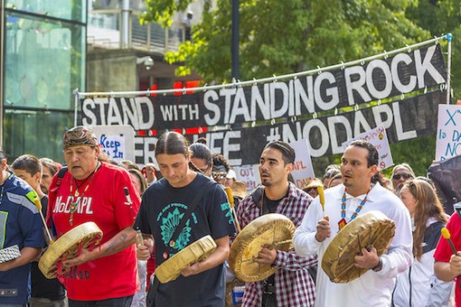
The names of towns and districts in North Dakota echo the violence of an earlier time, when the United States government pushed Native Americans off their ancestral lands onto reservations and, for many, to their deaths. One such town is Cannon Ball. It is in the heart of Sioux County on the Standing Rock Indian Reservation. North of Cannon Ball, on the Missouri river, is the town of Fort Rice, and south of it is Fort Yates. These are two old military forts from the days of the wars against Native Americans, which were oases for traders and settlers. Across the Missouri, about three hours’ drive east, is Whitestone Hill, where, in 1863, the U.S. forces defeated the exhausted detachments of the Lakota Sioux. West of Cannon Ball is Little Big Horn, where the Sioux had their greatest victory against the forces of General George Custer (the battle is known as Custer’s Last Stand). South of Cannon Ball is Wounded Knee, where the Sioux armies were fatally defeated in 1890. War and conflict surround the little town of Cannon Ball, itself named after the technologies of destruction that brought such grief to the Sioux and to other Native Americans.
Cannon Ball is now ground zero for a major fight between Native Americans and private energy firms —such as the benignly named Energy Transfer Partners—over the building of the Dakota Access Pipeline. This pipeline is part of an immense project to move fracked natural gas and crude oil to the major population centres of the U.S. It will run from North Dakota’s Bakken region to Illinois. Native Americans complain that the pipeline runs through their sacred lands, desecrating burial grounds and other cultural monuments. They worry that the pipeline will likely damage the Missouri river, the lifeline of the Standing Rock Sioux tribe’s reservation.

